Viñales
Meteorite fall (L6, >21,752.38 g) on 1 February 2019 near Viñales, Pinar del Río, Cuba at ~1:17:10 p.m. local time (~18:17:10 UTC)

On Friday, February 1, 2019, at ~1:17:10 p.m. local time (~18:17:10 UTC) a daytime bolide was observed and heard by many inhabitants of the Valle de Viñales, east of Viñales, in the province of Pinar del Río on Cuba. Seven weather stations of the area are reported to have recorded the event as well.
Fallen meteorites
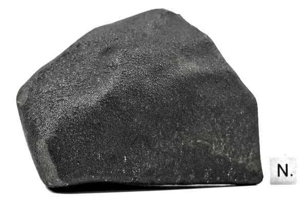
On 5 February 2019 it was estimated that officially almost 50 meteorite specimens (thermally metamorphosed ordinary chondrites, L6) had been found by locals. It is certain that up to at least one hundred more specimens have been found and partly been sold to meteorite dealers in the USA who started to sell them about a week after the fall. At the Mural de la Prehistoria fall site the local police seized two bigger and one smaller specimen in plastic bags for subsequent chemical analysis. US-based journalist Yusnaby Pérez reported on 3 February that the police of Pinar del Rio went from house to house to confiscate the meteorites people had found.
Meteorites are reported to have fallen in the area around the Mural de la Prehistoria, near Los Jazmines, at the Dos Hermanas camping site in the Valle de Dos Hermanas, in the Valle del Palmarito, in El Cuajaní and in and around the village Viñales, including its El Bostezo settlement. One meteorite was found on the road to Las Maravillas, at kilometer 26 to Puerto Esperanza. One meteorite is reported to have fallen in front of the Asamblea Municipal del Poder Popular of Viñales, as reported by José Antonio Valle Crespo, President of the same. On 27 March 2019 the fall was officially registered as Viñales (L6/S3 or S4) in the Meteoritical Bulletin Database.
Fragments of the specimen #36 Jazmines 1 found west of Los Jazmines have been deposited in the scientific meteorite collection of the Museum of Natural History in Vienna. The Jazmines specimen was split in two parts (NHMV-01191 and NHMV-13514) and a thin section (NHMV-13514) was made.
The Institute of Geophysics and Astronomy (Instituto de Geofísica y Astronomía, IGA) equally donated a meteorite fragment which will be officially delivered to the NHMV on 30 April 2019.
On 11 December 2019 Dr. Elba Rosa Montoya, Minister of Science, Technology and Environment inaugurated the permanent exhibition of a Viñales meteorite at the Museo de Historia Natural “Tranquilino Sandalio de Noda” of the Pinar del Río province.

Third strewn field map from EL METEORITO DE VIÑALES: CAMPO DE DISPERSIÓN Y DAÑOS OCASIONADOS by Manuel Vázquez-Torres, René M. Pino Torga (2019) in Anales de la Academia de Ciencias de Cuba Vol. 9, Núm. 1 Especial (2019)

Map of 64 Viñales meteorites with officially proven impact locations (impactos comprobados) in the strewn field (x/y: x = meteorite ID, y = given specimen weight in grams. Graph by karmaka based on data provided by Manuel Vázquez-Torres, René M. Pino Torga
Detailed data of 64 found meteorites with known impact locations. Total weight of specimens in list below: 21,752.38 grams. Source: EL METEORITO DE VIÑALES: CAMPO DE DISPERSIÓN Y DAÑOS OCASIONADOS by Manuel Vázquez-Torres, René M. Pino Torga (2019) in Anales de la Academia de Ciencias de Cuba Vol. 9, Núm. 1 Especial (2019)


The impact locations of 41 officially recovered meteorite specimens in a first map produced by geologist Manuel Vázquez Torres. Image: Manuel Vázquez Torres / Enrique Castellanos

A second updated version of the strewn field map. The red dots shown the officially confirmed fall locations of meteorites and the blue dots indicate officially not confirmed reported fall locations. Image: ACC/MINEM
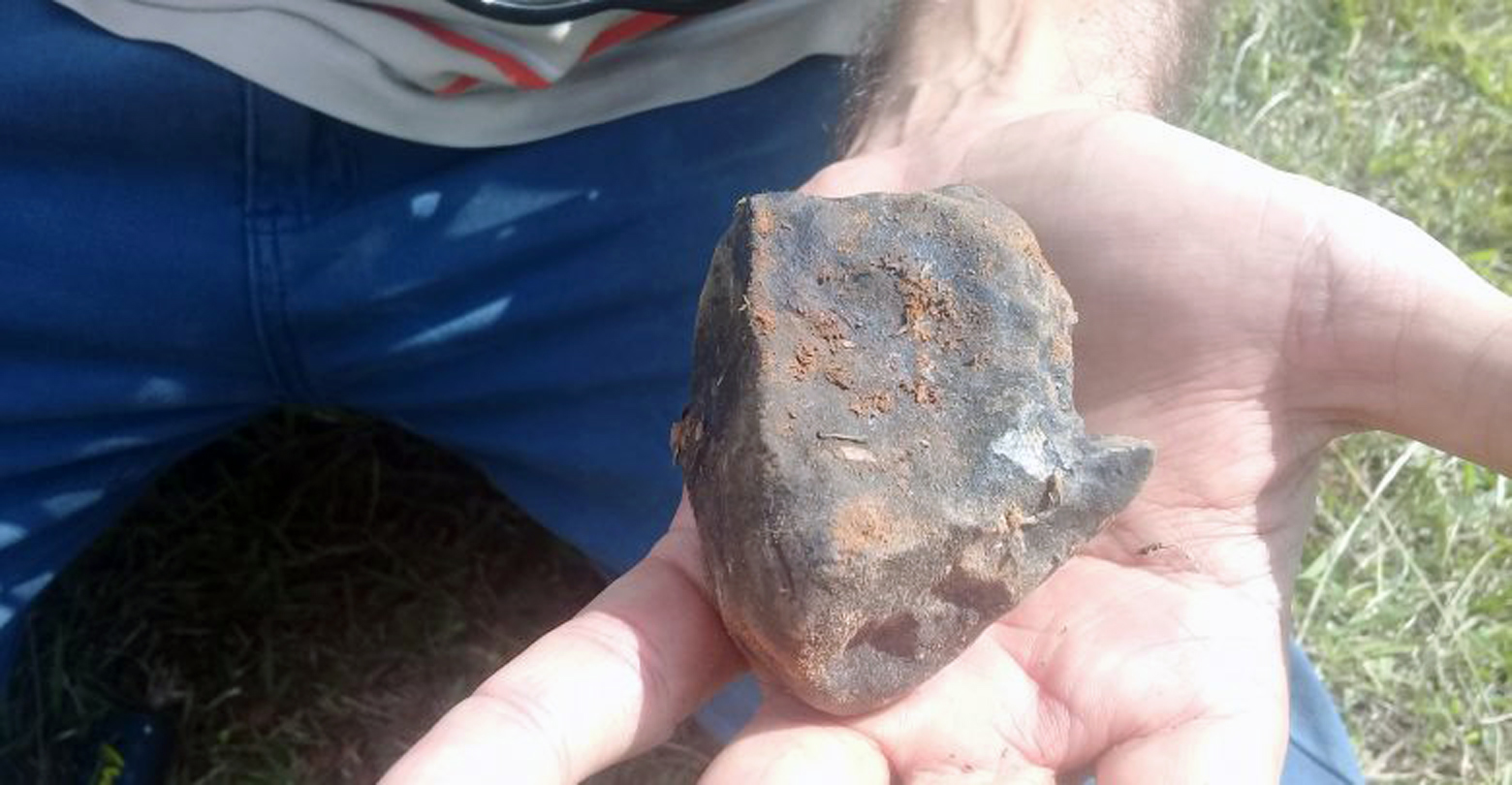
The three Restaurant Mural de la Prehistoria specimens
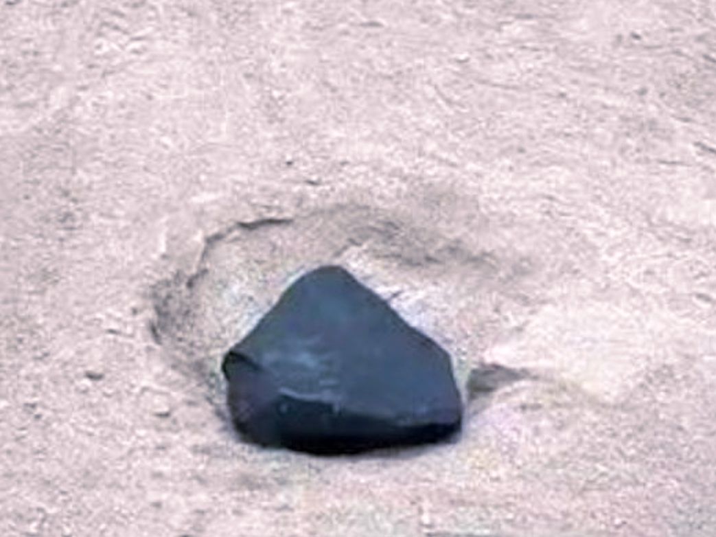
Several workers who had been working on a construction site at the souvenir shop near the Restaurant Mural de la Prehistoria close to the Mural de la Prehistoria tourist site heard the meteoroid’s detonation sounds and saw the ionization trail in the sky. Then they witnessed the fall of meteorites. At least three meteorite specimens have been found in the area of the Mural de la Prehistoria, the biggest weighs about 470 grams. A flat meteorite with a size of about 7 x 6 x 2 centimeters was found. Another one has a seize of about 8.5 x 8 centimeters in diameter. A third smaller specimen has a size of about 3.5 x 3 centimeters. The flat meteorite hit the orange plastic roof tiles of a canopy above an entrance door of the building at location 22°37’07.6″N 83°44’31.7″W and pierced a hole in it.
Eyewitness Rafael Damián Cabrera, who was working as a carpenter on the construction site at the Restaurant Mural de la Prehistoria during the fall of the meteorites, reports he heard a loud thundering sound, saw the ionization trail turning reddish and after a few minutes heard a meteorite fall through the orange plastic roof tiles of a canopy in front of him.
Another eye-witness on location was Wilber Pérez Miranda, who also recorded the ionisation trail in the sky with his smart phone.
Raynier Rivera Torres, a young man also known as Puchi, who was at the Mural during the fall reports that 5 minutes after he saw the ionization trail there was a rumble sound and he witnessed a meteorite fall through the roof of the house. He took the meteorite in his hand, made photos of it, ‘tasted’ the meteorite and found out that it smelled like gunpowder.


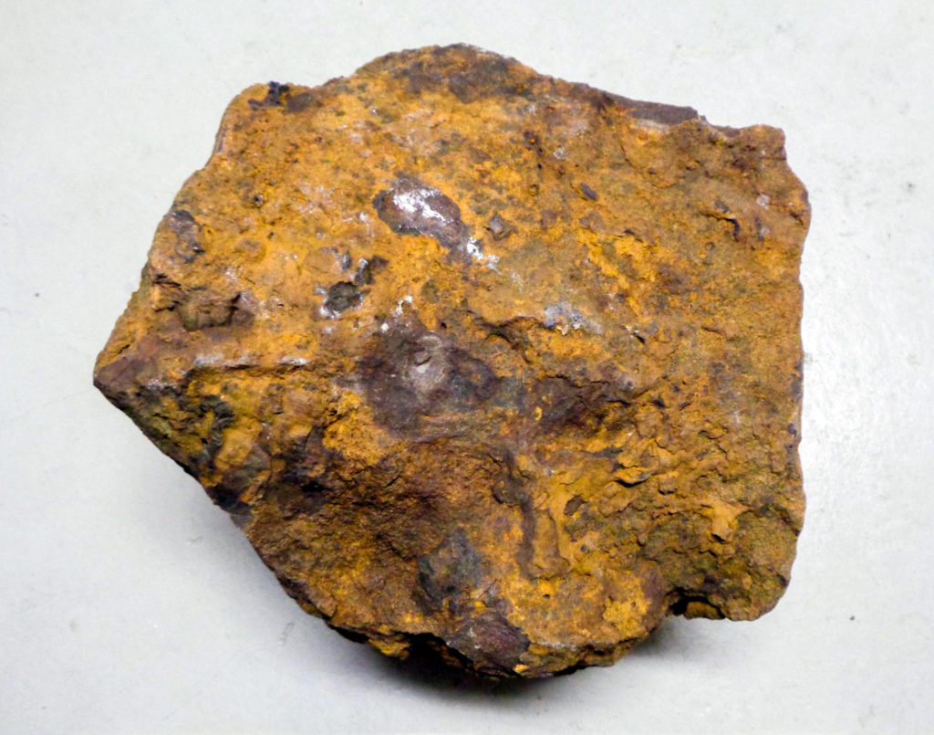
The biggest Mural specimen (~ 8.5 x 8 cm)


The meteorite being inspected, photographed and touched by several tourists and local eyewitnesses in the presence of a Cuban police officer next to the Restaurant Mural de la Prehistoria shortly after the meteorite fell on 1 February 2019. Video: Joel (joelpt2)
Another Mural specimen (~ 7 x 6 x 2 cm)


The impact hole in the roof of the souvenir shop near the restaurant
The hole caused by Vinales specimen No 47 (Mural 3) at location 22°37’7.598″, -83°44’31.961″ in the valley Dos Hermanas.


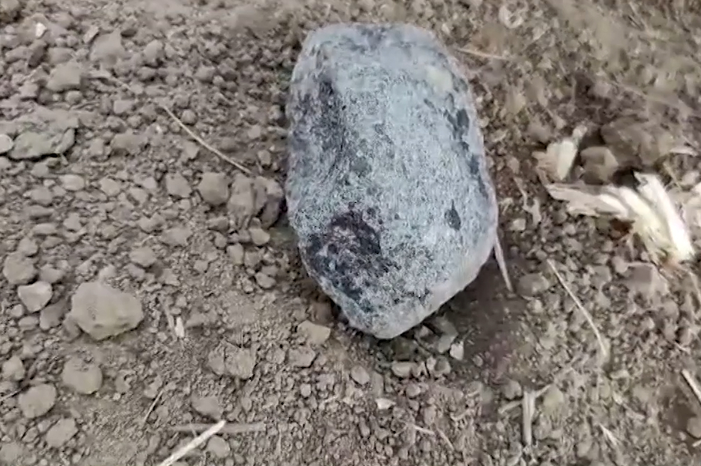
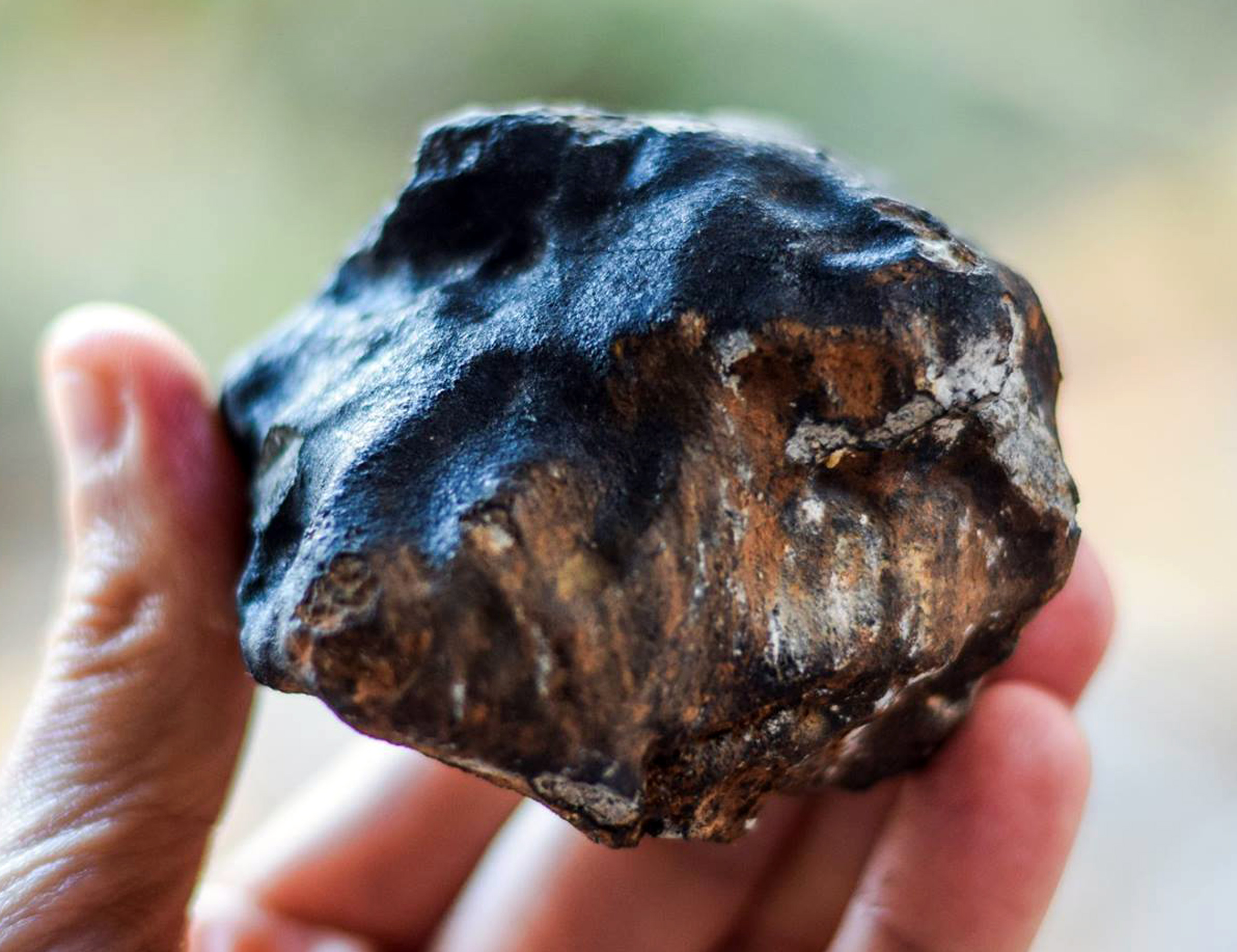
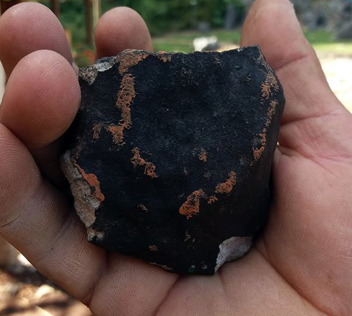
Diosmany Fernández’s 10.8-centimeter meteorite ( Viñales No 20, Coyon 1)


According to Dr. Efren Jaimez Salgado, a researcher of the National Institute of Geophysics and Astronomy, a 10.8-centimeter long specimen (Coyon 1, 1250 grams) with a volume of ~746.5 cm³ (?) has fallen in the Valle de Palmarito area north of Valle de Dos Hermanas and left an impact dent with a diameter of 13 cm and a depth of about 30 cm in a pasture of cattle at location 22°37’43.478″, -83°44’35.733″. It was a peasant called Diosmany Fernández, a resident of the Palmarito area, who was looking for his horse when he saw the bolide’s ionization trail and heard the bolide’s detonation booms. Some minutes later he felt something impact the ground about 15 meters behind him. Then he witnessed the fall of two other meteorites and realized that there had to be a relation to the trail in the sky. He ran into a little house for shelter and when he came out again to go to his horse he saw the meteorite and the impact dent next to the animal. Then he called two boys and together they took the meteorite into the house.

The 10.8-centimeter specimen (Muestra 8) among other meteorites collected by the Departamento de Geología Ambiental, Geofísica y Riesgos of the Instituto de Geofísica y Astronomía (IGA) shown at a press conference at the Instituto de Geofísica y Astronomía. Photo: Argelia Fernández
Luis Deulofeu’s meteorite fragments ( Viñales No 25)
When 57-year-old Luis Deulofeu first heard the meteoroid’s detonation booms he thought it was a military plane, a dynamite explosion at a local site or that a part of the house had collapsed. Then he heard something fall in front of the house and went outside. A meteorite had hit the pavement tiles in front of his house in Cuajaní at location 22.621230, -83.740972 and fragmented into at least 16 fragments on impact. As other witnesses at the Mural, including Rafael Damián Cabrera, who touched the meteorites immediately after they fell Deulofeu also confirmed that the meteorite fragments were not hot or warm when touched. He took photos of the impact location and picked up the fragments.


Viñales No 44 (Mirador)
Vinales meteorite 44 (Mirador), a 929-gram specimen, hit the roof of a house at location 22°37’34.244″, -83°44’42.076″ in the valley near Dos Hermanas.


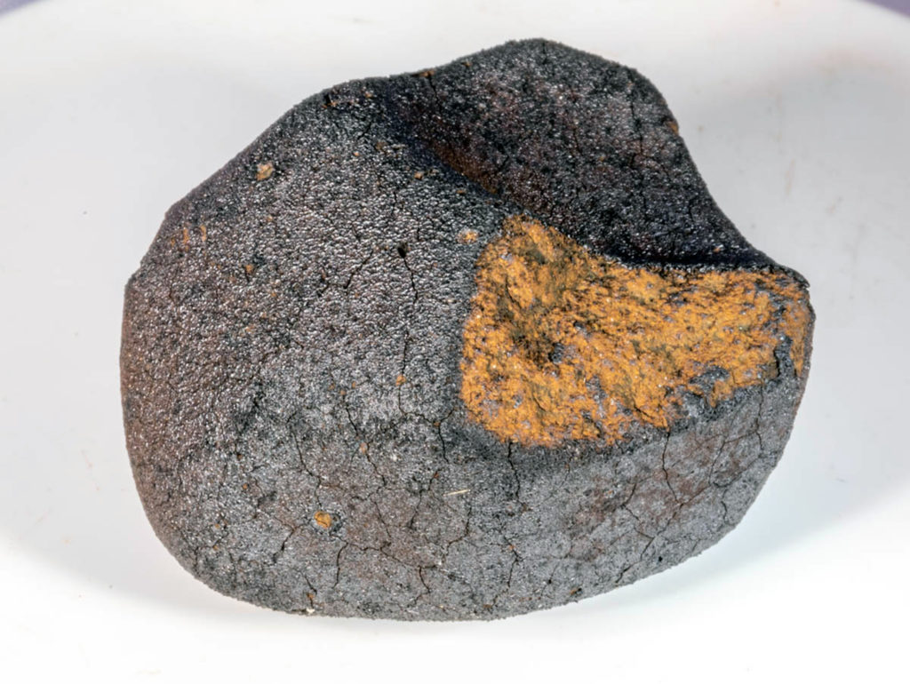
Viñales meteorite specimens
On 2 February video blogger Frank Camallerys Rivas presented a meteorite which is supposed to be another Viñales meteorite.


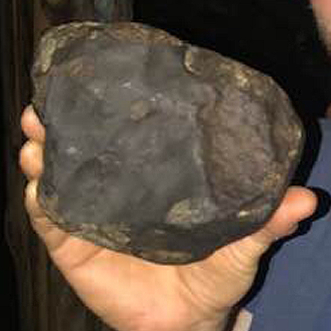
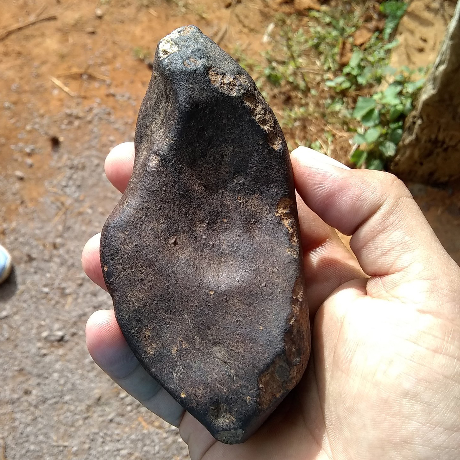
Photo: Juan Dainel


Photo: R. Ward

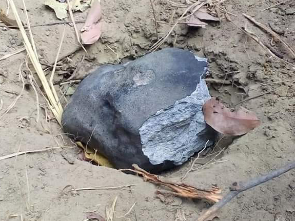
Meteorite in situ. Photo: Manuel A. Iturralde-Vinent (Academia de Ciencias de Cuba (ACC))
Excavation of meteorites
The excavation of a meteorite weighing about 300 grams. Video: Museo del Meteorito de Chile
Video: Space Rocks Hunters
The excavation of a meteorite. Video: Museo del Meteorito de Chile


Bolide’s atmospheric trajectory and orbit
Data shown in table below according to
Can we predict the impact conditions of meter-sized meteoroids?
Preprint, V3.0 (18 April 2019)
Jorge I. Zuluaga [SEAP/IF/UdeA], Pablo A. Cuartas-Restrepo [SEAP/IF/UdeA], Jhonatan Ospina [SAA/CAMO], Mario Sucerquia [SEAP/IF/UdeA]
Monthly Notices of the Royal Astronomical Society: Letters, Volume 486, Issue 1, June 2019, Pages L69–L73
Best-fit atmospheric trajectory, based on the video recordings from Havana Harbour, Fort Myers Beach and Pinar del Rio.
| Projected impact site location / Longitude (°) | -83.8037 ± 0.002 |
| Projected impact site location / Latitude (°) | 22.8820 ± 0.001 |
| Radiant azimuth Arad (°) | 178.9 ± 0.2 |
| Radiant elevation hrad (°) | 31.8 ± 0.1 |
| Reference azimuth Aref (°) | 193.1 ± 0.0 |
| <Vimp> (km/s) | 16.9 +0.15/-0.14 |
Orbital Data
| a (AU) | 1.217 +0.003/-0.004 |
| ω (°) | 276.975 +0.434/-0.507 |
| e | 0.391 +0.005/-0.007 |
| Ω (°) | 132.281 ± +0.002/-0.002 |
| q (AU) | 0.740 +0.004/-0.005 |
| i (°) | 11.471 +0.030/-0.038 |
| Tisserand parameter Tp (adim.) | 2.811 +0.005/-0.005 |
| Period Y | 1.342 +0.006/-0.007 |
Q = Aphelion, q = Perihelion, a = Semi-major axis, e = Eccentricity, i = Inclination, Ω = Ascending node longitude, ω = Argument of perihelion
Data shown in table below according to
Meteorite and bright fireball records from Cuba
Yasmani Ceballos Izquierdo, Johanset Orihuela León, Gabriel Gonçalves Silva, Marcelo Zurita, Daniela Cardozo Mourão, Henry Delgado Manzor
Mineralia Slovaca, 53, 2 (2021), 131 – 145
Best-fit atmospheric trajectory, based on the video recordings from Havana Harbour, Fort Myers Beach and photos by Cruz María Ruiz taken aboard Spirit flight 923 (Orlando to San Jose)
| Projected impact site location / Longitude (°) | -83.7238 ± 0.00 |
| Projected impact site location / Latitude (°) | 22.8692 ± 0.05 |
| Radiant azimuth Arad (°) | 171.8 +0/-0 |
| Radiant elevation hrad (°) | 39.5 +0.0/-0.0 |
| Reference azimuth Aref (°) | |
| <Vimp> (km/s) | 16.6 +0.0/-0.0 |
Orbital Data
| a (AU) | 1.038 ± 0.00 |
| ω (°) | 255.740 +0 /-0 |
| e | 0.371± 0.00 |
| Ω (°) | 132.343 ± 0.000 |
| q (AU) | 0.653 ± 0.00 |
| i (°) | 10.589 ± 0.0 |
| Tisserand parameter Tp (adim.) | 2.78± 0.02 |
| Period Y | 1.058 ± 0.0 |
Q = Aphelion, q = Perihelion, a = Semi-major axis, e = Eccentricity, i = Inclination, Ω = Ascending node longitude, ω = Argument of perihelion
U.S. Government sensor data from the Center for Near Earth Object Studies (CNEOS)
The table below contains the bolide’s geographic location, its altitude and velocity at peak brightness, its approximate total optical radiated energy and its calculated total impact energy. The pre-impact velocity components are expressed in a geocentric Earth-fixed reference frame defined as follows: the z-axis is directed along the Earth’s rotation axis towards the celestial north pole, the x-axis lies in the Earth’s equatorial plane, directed towards the prime meridian, and the y-axis completes the right-handed coordinate system.
| Peak brightness / Date and Time (UT) | 1 Feb. 2019, 18:17:10 |
| Latitude (°) | 22.5 N |
| Longitude (°) | 83.8 W |
| Altitude | 23.7 km |
| Pre-impact velocity | 16.3 km/s |
| Velocity Vx/Vy/Vz | -2.4/13.6/8.7 |
| Total Radiated Energy (J) | 57.9e10 |
| Calculated Total Impact Energy (kt) | 1.4 |
Video recordings of the bolide
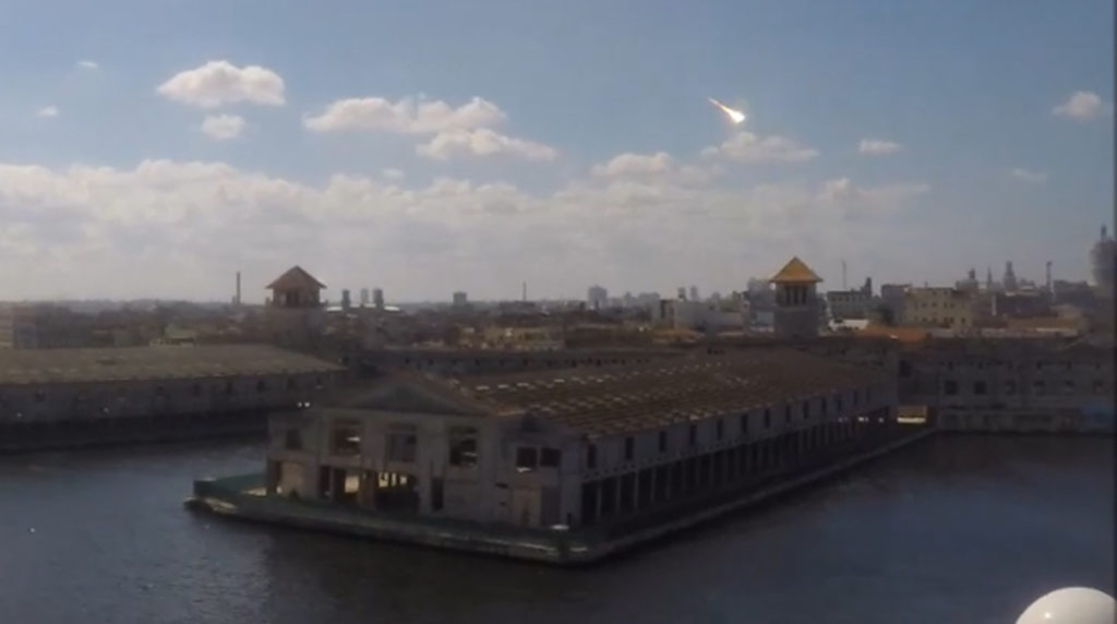
From Havana harbour
From Varadero
Bolide captured above the second docking berth of Terminal Sierra Maestra in Havana harbour. Video by Rachel Cook recorded with a GoPro Hero 5 in default time-lapse mode (0.5 seconds between frames) from location 23.13799, -82.344343 on Royal Caribbean’s cruise ship ‘Majesty of the Seas’ while leaving the terminal (~154.4 km from the impact location at Restaurant Mural de la Prehistoria). First published on 2 February 2019, then shortened and republished on 11 February by Zuluaga et al. .
From Fort Myers Beach, Florida
Video recorded by an Earth Cam at the roof of the GullWing Beach Resort at Fort Myers Beach, Florida, USA at the approximate location 26.418871, -81.903596 (~ 461.6 km from the impact location at Restaurant Mural de la Prehistoria). Recorded for 1.87 seconds. Estimated azimuth of the trail: from 10.1±0.1 degrees at a height of 2.5±0.03 degrees to an estimated azimuth of 11.5±0.01 degrees at a height of 0.8±0.3 degrees. Video: unknown
Video by Dwight Misiak, we found to be most likely recorded from location 23°11’50.84″N, 81° 8’27.31″W during a bus transfer on the Autopista Sur, Varadero, Cárdenas, Cuba (~274.09 km from the impact location at the Restaurant Mural de la Prehistoria).
Photos of the bolide
Cruz María Ruiz from Arecibo photographed the bolide by accident while taking photos during her Spirit Airlines flight 923 at an estimated altitude of about 37,000 feet (11,277 meters) from Orlando in Florida to San Jose in Costa Rica. In the foreground of the left photo below looking west-northwest the cays Cayo Cacao, Cayo Juan Ruiz, Cayo Cordas and Cayos Providencias near the southern coast of the Península de Zapata (on the right in the left photo) can be seen. The distance between the Cayo Cacao (22.133174, -81.902498) at the bottom of the left image and the fall location at the Mural de la Prehistoria is 205.6 kilometers.


Photos of the ionization trail

Trail. Photo published by Yusnaby Pérez

Seen from Havana. Photo: Asniel Herrera González
Video recordings of the ionization trail
The trail and detonation booms at 0:47 min. running time. Video: Juán Alberto Pérez Pozo from Pinar del Río.
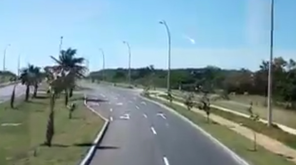
Video from near the crossing of Autopista Este-Oeste and Ciprian Valdes in Pinar del Rio (Cuba) at location 22.414536, -83.692091, altitude 48 meters. Azimuth of the trail: from 287.61±0.1 degrees at a height of 76.9±5 degrees to an azimuth of 318.07±5 degrees at a height of 57.8±5 degrees. Video published by Hatzel Vela
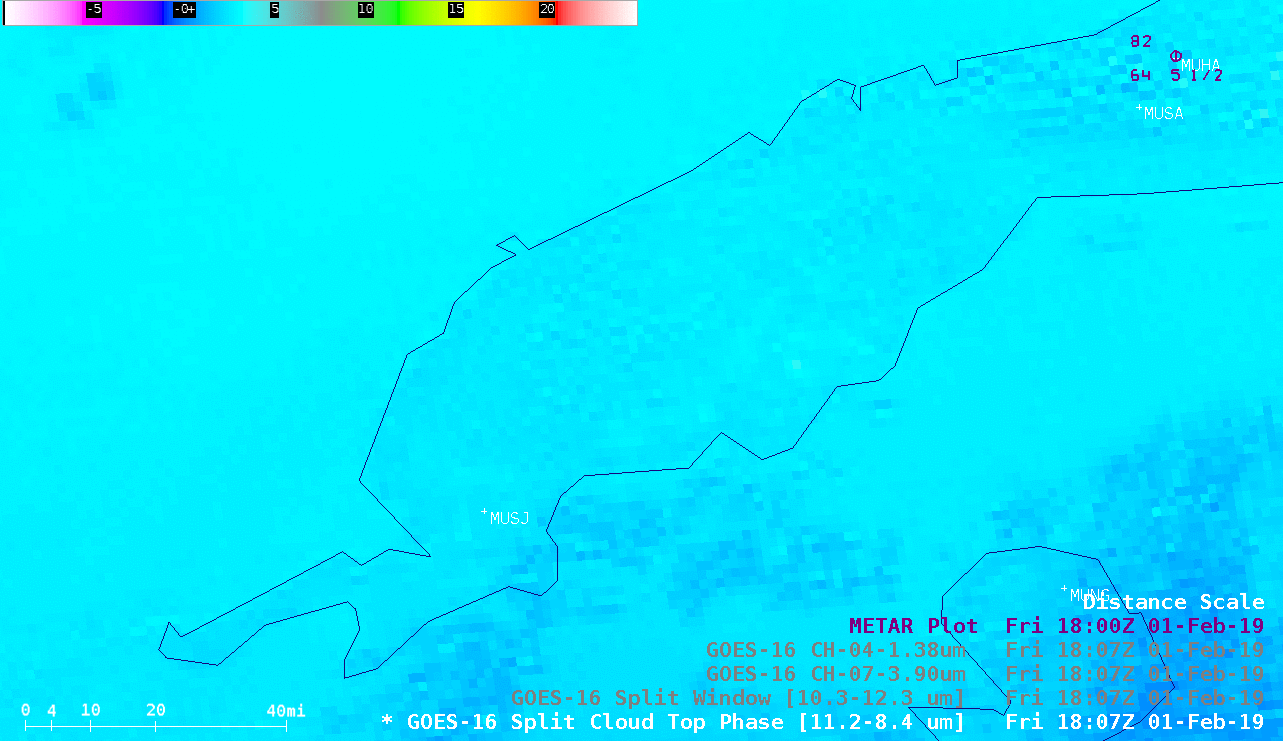
Weather radar and GEOS-16 satellite images
Signatures of falling meteorites in KBYX (Key West) NEXRAD weather radar images at a distance of over 300 km. “The first appearance of falling meteorites on radar occurs at 18:18:14 UTC and 10,600 m above sea level (ASL) in the 1816 UTC data set for the KBYX radar in the 0.88 degree elevation radar sweep. Signatures consistent with falling meteorites appear in a total of three radar sweeps from the KBYX radar, with a final signature appearing at 18:22:02 UTC.” (NASA)


Estimated strewn field. Dark red represents potential 10 kg-mass meteorites, yellow represents single-gram meteorites, orange area represents masses of up to several hundred grams and actually covers the area of the confirmed fall locations of meteorites. Atmospheric winds from a western direction shape the calculated strewn field. The green line represents the calculated bolide trajectory. Image: NASA
GOES-16 Volcanic Ash RGB animation (Day Cloud Phase RGB (UL)), 1 Feb. 2019, 18:02 UTC–19:32 UTC. Image: Hans Peter Rosesli
Data delivered by the Geosynchronous Lightning Mapper (GLM) instrument on the Geostationary Operational Environmental Satellites (GOES), operated by NASA and the National Oceanic and Atmospheric Administration (NOAA). A small sulfur dioxide (SO2) atmospheric plume of the bolide was observed by GOES-16 (GOES-East). Time period from 18.12 to 18.32 UTC. “GOES-16 Split Cloud Top Phase (11.2 – 8.4 µm), Split Window Difference (10.3 – 12.3 µm), Near-Infrared “Cirrus” (1.37 µm) and “Red” Visible (0.64 µm) images (below) revealed signatures of the airborne debris cloud as it drifted northeastward then eastward for about an hour after impact. During that hour (from 18:17 to 19:17 UTC) the debris cloud traveled about 40 miles. A brief signature of another (lower-altitude) debris cloud moving southwestward was also seen immediately following impact, which was most apparent in the Split Window and Cirrus images. The signatures in the Split Cloud Top Phase and Split Window imagery were due to the presence of mineral dust particles within the debris cloud — the emissivity properties of dust affects the sensed brightness temperatures differently for various infrared spectral bands. The Cirrus spectral band is useful for detecting the scattering of light by airborne particles such as ice crystals, volcanic ash, smoke or dust. The debris cloud was also casting a subtle shadow onto the surface, as seen in the Visisble imagery. ” Data and images: NOAA’s Cooperative Institute for Meteorological Satellite Studies (CIMSS)
CLICK IMAGE ABOVE to animate graphic loop in pop-up window.

CLICK IMAGE ABOVE to start animation loop (18:17 – 18:28 UTC, 1 Feb. 2019) of GLM Flash Extent Density (FED) values overlaying GEOS-16 visible (0.64 µm) imagery. Image: NOAA
GEOS-16 GLM accumulated grids animation , colored by energy from 18:17:08.700 to 18:17:12.400 UTC. The Geostationary Lightning Mapper (GLM) was designed for mapping lightning flashes. It takes 500 images every second, which enables it to measure the luminous energy and length of a bolide’s ‘light curve’ with a millisecond precision. Image: Eric Bruning

Bolide’s ground track length, luminous energy [J] and light curve duration based on GOES-16’s GLM data. Image: Clemens Rumpf (2 Feb. 2019)
Scientific literature
Meteorite and bright fireball records from Cuba
Yasmani Ceballos Izquierdo, Johanset Orihuela León, Gabriel Gonçalves Silva, Marcelo Zurita, Daniela Cardozo Mourão, Henry Delgado Manzor
Mineralia Slovaca, 53, 2 (2021), 131 – 145
Can we predict the impact conditions of meter-sized meteoroids?
Jorge I. Zuluaga [SEAP/IF/UdeA], Pablo A. Cuartas-Restrepo [SEAP/IF/UdeA], Jhonatan Ospina [SAA/CAMO], Mario Sucerquia [SEAP/IF/UdeA]
Submitted to MNRAS Letters
Published on 11 February 2019
Anales de la Academia de Ciencias de Cuba
Vol. 9, Núm. 1 Especial (2019)
Meteorito caído en Cuba: por los caminos de la verdad científica
Luis Velázquez-Pérez
“Muestra una colección de trabajos científicos dedicados al estudio del meteorito que el pasado primero de febrero de 2019, se desintegró a su paso por la atmósfera y cayó en múltiples pedazos, que impactaron a la ciudad de Viñales y sus alrededores, sin causar daño alguno. Los autores son especialistas en distintas ramas de las ciencias de la Tierra y del Espacio, que utilizando los recursos técnicos disponible en el país, desentrañaron la historia de los meteoritos reconocidos y estudiados previamente en Cuba. Determinando la composición química y mineralógica del fragmento caído cerca del hotel Los Jazmines; y otros datos que permitieron clasificar como condrito ordinario L6, a este cuerpo rocoso extraterrestre. Hasta el presente fue el primer meteorito caído en Cuba que haya sido sometido a un análisis tan minucioso.”
RECUENTO DE LOS METEORITOS REPORTADOS EN CUBA Y BIBLIOGRAFÍA SOBRE EL TEMA
Yasmani Ceballos-Izquierdo
“En Cuba hay varios antecedentes sobre la caída de meteoritos desde 1867 pero pocos han sido recuperados e investigados. Recientemente, la caída en Viñales (Pinar del Río) de fragmentos de un bólido vuelve a poner en la mira de la comunidad científica un tema de gran interés. Por tal razón se ha revisado la información disponible de los ejemplares históricos, incluyendo publicaciones originales y catálogos de colecciones en museo. Como resultado se presenta un recuento de los meteoritos en Cuba, incluyendo una compilación de la bibliografía sobre el tema”
EL METEORITO DE VIÑALES: CAMPO DE DISPERSIÓN Y DAÑOS OCASIONADOS
Manuel Vázquez-Torres, René M. Pino Torga
“La lluvia de fragmentos de meteorito que impactó el Parque Nacional Viñales el 1 de febrero de 2019 a las 13:17, justo dentro de los límites del área declarada Paisaje Cultural de la Humanidad, generó un campo de dispersión elíptico con su eje longitudinal orientado a unos 15o al NNE. Esta orientación es consistente con la trayectoria de vuelo reportada por la investigación realizada por astrónomos de la Universidad de Antioquia (Colombia), los que estimaron que el meteoroide entró a la atmósfera a unos 64,800 km/h con una masa original de 330 tm, en un punto al suroeste de Cuba sobre el mar Caribe, hasta caer en Viñales (Wall, 2019). Los fragmentos se dispersaron en un área aproximada de 150 km2, que incluyó Los Jazmines, el valle de Viñales con el pueblo, el mogote El Valle, valle de Dos Hermanas y valle de Ancón. Hasta la fecha se han reportado un total de 64 impactos comprobados, los cuales causaron daños ligeros en algunos techos y pavimento. En el presente trabajo se elaboró un catastro y un mapa de los puntos de impactos comprobados y reportados, así como aquellos que se estima pudieron caer en terrenos no accesibles o sin presencia de testigos. Sobre esta base se trazó la elipse de dispersión de los impactos y la dirección más probable de la trayectoria cercana a la tierra de los fragmentos.”
ESTUDIO ESPECTROSCÓPICO, COMPOSICIONAL Y MINERALÓGICO DE UN FRAGMENTO DEL METEORITO VIÑALES, CAÍDO EN LOS JAZMINES, CUBA OCCIDENTAL
Manuel A. Iturralde-Vinent, Angélica I. Llanes-Castro, María Santa Cruz-Pacheco, Carlos A. Toledo-Sánchez, Ileana Cabrera-Díaz
“En este trabajo se ofrecen los resultados del estudio mediante microscopías óptica y electrónica y espectrometrías de rayos X y Raman Confocal, de una muestra del meteorito caído en Viñales, Pinar del Río, Cuba. El ejemplar caído en Los Jazmines tenía forma tabular (11 x 9 x 4.5 cm, 1 kg) con la superficie ondulada por depresiones regmaglípticas. La roca es una brecha compuesta por muchos fragmentos de bordes angulares, con grietas rellenas de una fina diseminación de granos minerales, especialmente metálicos. Los fragmentos mayores tienen rasgos texturales y composición química semejante a una roca ígnea ultramáfica, con O (~46.7%), Si (~16.8), Fe (~14.2%) y Mg (~12.2%), así como Al (~1.82%), S (~1.83%), Ca (~1.78%), Na (~1.33%), Ni (~0.57%), Cr (~0.29%) y K (~0.25%). Los minerales más representativos son olivino (Fo78/Fa22) ~44.73%, plagioclasa sódica ~13%, piroxeno (augita) ~12.6%, troilita ~4.47%, taenita ~3.35%, cromita ~0.62%, muy rara Kamacita, así como escaso hierro metálico y plomo. La textura es condrítica, heterogranoblástica, por partes de aspecto porfírica por la presencia de minerales metálicos diseminados. La matriz es de color blanco a verde pálido. Los cóndrulos (~25%), a menudo obliterados, alcanzan 0.6, 1.0 y 1.6 mm de diámetro. El ejemplar muestra recristalización y cataclásis por metamorfismo térmico y de choque. No se observa meteorización. El ejemplar de Los Jazmines se clasifica como una condrita ordinaria (L6/S4/W0). Se asemeja en su composición mineralógica al meteorito Kamargaon (L6).”