Geological Map of Vesta
Geological Map of Vesta

Credit: NASA/JPL-Caltech/ASU
Vesta Topography Map
Geological Map of Vesta

Credit: NASA/JPL-Caltech/ASU
Vesta Topography Map
| M | T | W | T | F | S | S |
|---|---|---|---|---|---|---|
| 1 | ||||||
| 2 | 3 | 4 | 5 | 6 | 7 | 8 |
| 9 | 10 | 11 | 12 | 13 | 14 | 15 |
| 16 | 17 | 18 | 19 | 20 | 21 | 22 |
| 23 | 24 | 25 | 26 | 27 | 28 | |
87th Annual Meeting of The Meteoritical Society 2025 – PROGRAM
Annual Meeting of The Meteoritical Society 2024 – PROGRAM
Annual Meeting of The Meteoritical Society 2023 – PROGRAM
Annual Meeting of The Meteoritical Society – PROGRAM
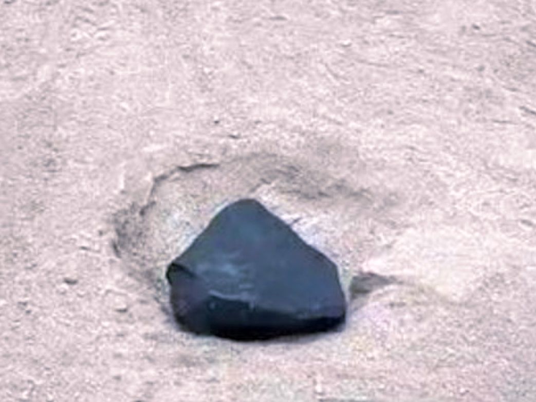
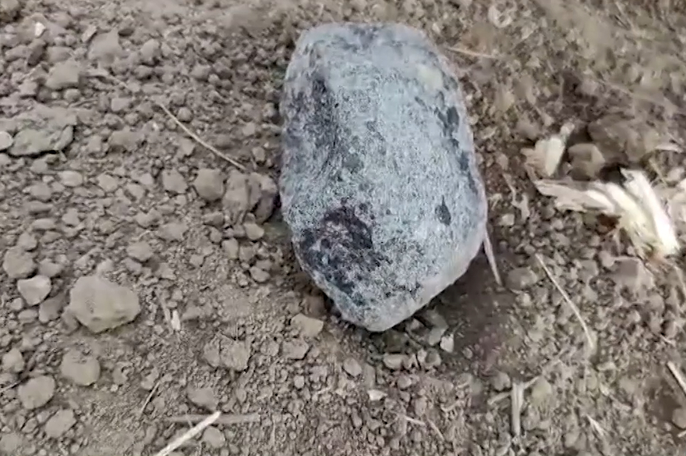
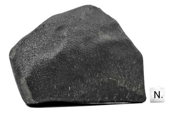


PORTELÂNDIA meteorite fall (~200g, L5) near Portelândia, Goiás, Brasil on 17 July 2022

Meteorite fall in Falealupo-Tai, Vaisigano, Savai’i, Samoa on 3 February 2021


PULI ILKARINGURU meteorite fall (H5, 18 November 2019) on the Nullarbor Plain, Western Australia

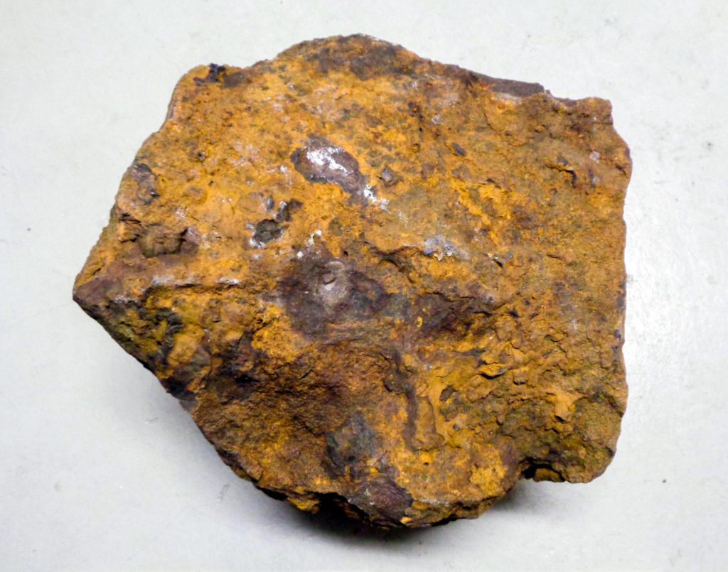

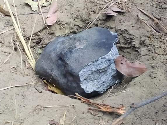
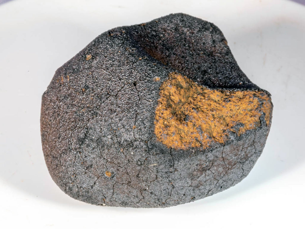
Meteorite “Hocheppan” –
a Forensic Study
by Karl Wimmer
POPULAR POSTS
(162173) Ryugu Allende aqueous alteration asteroid asteroid surface bolide CAI carbonaceous carbonaceous chondrite Chelyabinsk / Челябинск chondrule chondrule formation CI CM comet CR CV early solar system Earth enstatite chondrite Hayabusa-2 iron lunar Mars martian meteor meteoroid moon Murchison ordinary chondrite organic matter oxygen isotopes planetesimal presolar grains protoplanetary disk sample return mission shergottite shock metamorphism water witnessed fall
Self-assembled versus biological pattern formation in geology ►
Insights from early life in the 3.45-Ga Kitty’s Gap Chert for the search for elusive life in the Universe ►
Evidence for Hadean mafic intrusions in the Nuvvuagittuq Greenstone Belt, Canada ►
Growth of continental crust and lithosphere subduction in the Hadean revealed by geochemistry and geodynamics ►
Evidence for oceans pre-4300 Ma confirmed by preserved igneous compositions in Hadean zircon
►
Sediment subduction in Hadean revealed by machine learning ►
Onset of the Earth’s hydrological cycle four billion years ago or earlier ►
No evidence of supracrustal recycling in Si-O isotopes of Earth’s oldest rocks 4 Ga ago ►
The Eoarchean Muzidian gneiss complex: Long-lived Hadean crustal components in the building of Archean continents ►
Organic carbon generation in 3.5-billion-year-old basalt-hosted seafloor hydrothermal vent systems ►
Quantifying the effect of late bombardment on terrestrial zircons ►
Direct age constraints on the magnetism of Jack Hills zircon ►
An evolutionary system of mineralogy, Part VI: Earth’s earliest Hadean crust (>4370 Ma) ►
The mobilization of boron and lithium in the hydrothermal system of the ~ 3.48 Ga Dresser caldera: A stable isotope perspective ►
Advanced two- and three-dimensional insights into Earth’s oldest stromatolites (ca. 3.5 Ga): Prospects for the search for life on Mars ►
A persistent Hadean–Eoarchean protocrust in the western Yilgarn Craton, Western Australia ►
Toward RNA Life on Early Earth: From Atmospheric HCN to Biomolecule Production in Warm Little Ponds ►
Zircon-modeled melts shed light on the formation of Earth’s crust from the Hadean to the Archean ►
Triple oxygen isotope evidence for a hot Archean ocean ►
Oxygen isotope insights into the Archean ocean and atmosphere ►
Freshwater and Evaporite Brine Compositions on Hadean Earth: Priming the Origins of Life ►
Metabolically diverse primordial microbial communities in Earth’s oldest seafloor-hydrothermal jasper ►
Abiotic anoxic iron oxidation, formation of Archean banded iron formations, and the oxidation of early Earth ►
Oxygen production and rapid iron oxidation in stromatolites immediately predating the Great Oxidation Event ►
No mantle residues in the Isua Supracrustal Belt ►
Early Earth zircons formed in residual granitic melts produced by tonalite differentiation ►
Hadean zircon formed due to hydrated ultramafic protocrust melting ►
Cellular remains in a ~3.42-billion-year-old subseafloor hydrothermal environment ►
A CO2 greenhouse efficiently warmed the early Earth and decreased seawater 18O/16O before the onset of plate tectonics ►
Ingredients for microbial life preserved in 3.5 billion-year-old fluid inclusions
►
Elements for the Origin of Life on Land: A Deep-Time Perspective from the Pilbara Craton of Western Australia
►
A Reconstructed Subaerial Hot Spring Field in the ∼3.5 Billion-Year-Old Dresser Formation, North Pole Dome, Pilbara Craton, Western Australia
►
Inclusions in impact-formed zircon a 1 s a tracer of target rock lithology: Implications for Hadean continental crust composition and abundance ►
Boron partitioning between zircon and melt: Insights into Hadean, modern arc, and pegmatitic settings ►
Reappraisal of purported ca. 3.7 Ga stromatolites from the Isua Supracrustal Belt (West Greenland) from detailed chemical and structural analysis ►
Compositional heterogeneity of Archean mantle estimated from Sr and Nd isotopic systematics of basaltic rocks from North Pole, Australia, and the Isua supracrustal belt, Greenland ►
Unraveling the complexity of zircons from the 4.0-2.9 Ga Acasta Gneiss Complex ►
An andesitic source for Jack Hills zircon supports onset of plate tectonics in the Hadean ►
Sulfidization of 3.48 billion-year-old stromatolites of the Dresser Formation, Pilbara Craton: Constraints from in-situ sulfur isotope analysis of pyrite ►
Paleomagnetism indicates that primary magnetite in zircon records a strong Hadean geodynamo ►
Origins of high δ18O in 3.7–3.6 Ga crust: A zircon and garnet record in Isua clastic metasedimentary rocks ►
A comparison between zircons from the Acasta Gneiss Complex and the Jack Hills region ►
Accumulation of Transition Metals and Metalloids in Sulfidized Stromatolites of the 3.48 Billion–year–old Dresser Formation, Pilbara Craton ►
Disturbances in the Sm–Nd isotope system of the Acasta Gneiss Complex—Implications for the Nd isotope record of the early Earth ►
The accumulation of non-formula elements in zircons during weathering: Ancient zircons from the Jack Hills Western Australia ►
Nano−porous pyrite and organic matter in 3.5-billion-year-old stromatolites record primordial life ►
Lack of late-accreted material as the origin of 182W excesses in the Archean mantle: Evidence from the Pilbara Craton, Western Australia ►
The Eoarchean legacy of Isua (Greenland) worth preserving for future generations ►
A new 3.59 Ga magmatic suite and a chondritic source to the east Pilbara Craton ►
Reassessing evidence of life in 3,700-million-year-old rocks of Greenland ►
Evidence for evolved Hadean crust from Sr isotopes in apatite within Eoarchean zircon from the Acasta Gneiss Complex ►
Petrogenesis and tectonics of the Acasta Gneiss Complex derived from integrated petrology and 142Nd and 182W extinct nuclide-geochemistry ►
Earth’s oldest stable crust in the Pilbara Craton formed by cyclic gravitational overturns ►
Most Ancient Evidence for Life in the Barberton Greenstone Belt: Microbial Mats and Biofabrics of the ∼3.47 Ga Middle Marker Horizon ►
Ideas and perspectives: hydrothermally driven redistribution and sequestration of early Archaean biomass – the “hydrothermal pump hypothesis” ►
HCN production via Impact Ejecta Reentry during the Late Heavy Bombardment ►
Secondary magnetic inclusions in detrital zircons from the Jack Hills, Western Australia, and implications for the origin of the geodynamo ►
The origin of the Moon within a terrestrial synestia ►
Halogen Chemistry and Hydrogen Isotopes of Apatite from the >3.7 Ga Isua Supracrustal Belt, SW Greenland ►
Remarkably preserved tephra from the 3430 Ma Strelley Pool Formation, Western Australia: Implications for the interpretation of Precambrian microfossils ►
A 4463 Ma apparent zircon age from the Jack Hills (Western Australia) resulting from ancient Pb mobilization ►
Cluster analysis on a sphere: Application to magnetizations from metasediments of the Jack Hills, Western Australia ►
SIMS analyses of the oldest known assemblage of microfossils document their taxon-correlated carbon isotope compositions ►
Geochronology of Hadean zircon grains from the Jack Hills, Western Australia constrained by quantitative scanning ion imaging ►
Spatially-resolved isotopic study of carbon trapped in ∼3.43 Ga Strelley Pool Formation stromatolites ►
SIMS Microanalysis of the Strelley Pool Formation Cherts and the Implications for the Secular-Temporal Oxygen-isotope Trend of Cherts ►
Earth’s volatile contents established by melting and vaporization ►
Magnesium isotope evidence that accretional vapour loss shapes planetary compositions ►
Early trace of life from 3.95 Ga sedimentary rocks in Labrador, Canada ►
Impact-driven subduction on the Hadean Earth ►
Cubic zirconia in >2370 °C impact melt records Earth’s hottest crust ►
Elements of Eoarchean life trapped in mineral inclusions ►
CO2 fluid inclusions in Jack Hills zircons ►
Processes of Crust Formation in the Early Earth Imaged through Hf isotopes from the East Pilbara Terrane ►
Earliest signs of life on land preserved in ca. 3.5 Ga hot spring deposits ►
Formation of Hadean granites by melting of igneous crust ►
Large and robust lenticular microorganisms on the young Earth ►
Tungsten-182 heterogeneity in modern ocean island basalts ►
Evidence for early life in Earth’s oldest hydrothermal vent precipitates ►
Earth’s first stable continents did not form by subduction ►
SHRIMP U–Pb zircon geochronology establishes that banded iron formations are not chronostratigraphic markers across Archean greenstone belts of the Pilbara Craton ►
The Hunt for Shocked Zircon in the Jack Hills: 21,000 and Counting… ►
Initiation of plate tectonics in the Hadean: Eclogitization triggered by the ABEL Bombardment ►
Highly siderophile element and 182W evidence for a partial late veneer in the source of 3.8 Ga rocks from Isua, Greenland ►
Iron and oxygen isotope fractionation during iron UV photo-oxidation: Implications for early Earth and Mars ►
Coupled zircon Lu–Hf and U–Pb isotopic analyses of the oldest terrestrial crust, the >4.03 Ga Acasta Gneiss Complex ►
Sluggish Hadean geodynamics: Evidence from coupled 146,147Sm–142,143Nd systematics in Eoarchean supracrustal rocks of the Inukjuak domain (Québec) ►
The effect of weathering on U-Th-Pb and oxygen isotope systems of ancient zircons from the Jack Hills, Western Australia ►
No evidence for Hadean continental crust within Earth’s oldest evolved rock unit ►
Rapid emergence of life shown by discovery of 3,700-million-year-old microbial structures ►
Petrology and geochemistry of mafic rocks in the Acasta Gneiss Complex: Implications for the oldest mafic rocks and their origin ►
Recovering the primary geochemistry of Jack Hills zircons through quantitative estimates of chemical alteration ►
The birth of a cratonic nucleus: lithogeochemical evolution of the 4.02–2.94 Ga Acasta Gneiss Complex ►
Preservation of Earth-forming events in the tungsten isotopic composition of modern flood basalts ►
Geochemistry and Nd isotopic characteristics of Earth’s Hadean mantle and primitive crust ►
Early Earth Differentiation Investigated Through 142Nd, 182W, and Highly Siderophile Element Abundances in Samples From Isua, Greenland ►
Excavation and Melting of the Hadean Continental Crust by Late Heavy Bombardment ►
Potentially biogenic carbon preserved in a 4.1 billion-year-old zircon ►
Core formation and core composition from coupled geochemical and geophysical constraints ►
Pervasive remagnetization of detrital zircon host rocks in the Jack Hills, Western Australia and implications for records of the early geodynamo ►
— Comment by R. Bono et al (4 July 2016) ►
— Benjamin P. Weiss et al. (19 July) Reply to Comment by R. Bono et al (4 July 2016) ►
Copyright © 2026 karmaka.de
Powered by WordPress and Ascetica
.

